EnvironmentPlaneModeling
What Is This
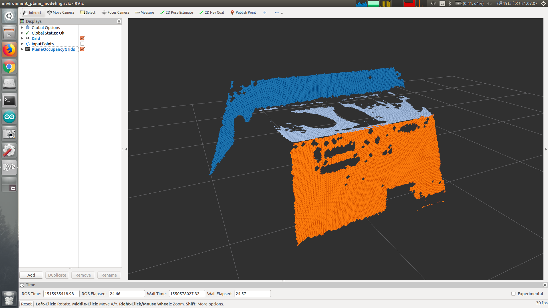
Make environment plane model as occupancy grid from point cloud, plane indices, plane polygons and plane normal coefficients.
Subscribing Topic
~input(sensor_msgs/PointCloud2)Input point cloud which contains normal for each point.
This topic is used for converting plane indices and coefficients into convex polygon.
~input/full_cloud(sensor_msgs/PointCloud2)Input point cloud which contains normal for each point.
This topic is used for building grid map.
~input/indices(jsk_recognition_msgs/ClusterPointIndices)Input point indices of plane.
~input/polygons(jsk_recognition_msgs/PolygonArray)Input polygons of plane.
~input/coefficients(jsk_recognition_msgs/ModelCoefficientsArray)Input normal coefficients of plane.
These 5 topics described above must be synchronized.
~input/leg_bounding_box(jsk_recognition_msgs/BoundingBox)Optional input bounding box.
Used only when
~complete_footprint_regionis true./move_base_simple/goal(geometry_msgs/PoseStamped)Optional input pose which a user wants robot to move to.
Publishing Topic
~output(jsk_recognition_msgs/SimpleOccupancyGridArray)Occupancy grid of plane.
~output/non_plane_indices(pcl_msgs/PointIndices)Point indices of non-plane region.
~debug/magnified_polygons(jsk_recognition_msgs/PolygonArray)Magnified plane polygons for debugging.
~debug/convex_cloud(sensor_msgs/PointCloud2)Vertex point cloud of convex polygons.
~debug/plane_poses(geometry_msgs/PoseArray)Pose of plane for debugging.
~debug/magnified_plane_poses(geometry_msgs/PoseArray)Pose of magnified plane for debugging.
~debug/raw_grid_map(jsk_recognition_msgs/SimpleOccupancyGridArray)Occupancy grid of plane before applying morphological dilation & erosion.
~debug/noeroded_grid_map(jsk_recognition_msgs/SimpleOccupancyGridArray)Occupancy grid of plane to which morphological filter is applied, but not enough erosion.
/footstep_simple/goal(geometry_msgs/PoseStamped)Output pose of suitable grid.
Only published when
/move_base_simple/goalis subscribed.
Parameter
~complete_footprint_region(Bool, default:False)Set to true if you want to complete grid map by
~input/leg_bounding_box.~footprint_frames(List of String, default:[])Frame ID used for looking up ground plane for footprint.
Used only when
~complete_footprint_regionis true.
Sample
roslaunch jsk_pcl_ros sample_environment_plane_modeling.launch